
Apple's contribution to the fight against the COVID-19 crisis is moving into the next round. The company has now released a tool that allows access to mobility data from Apple Maps.
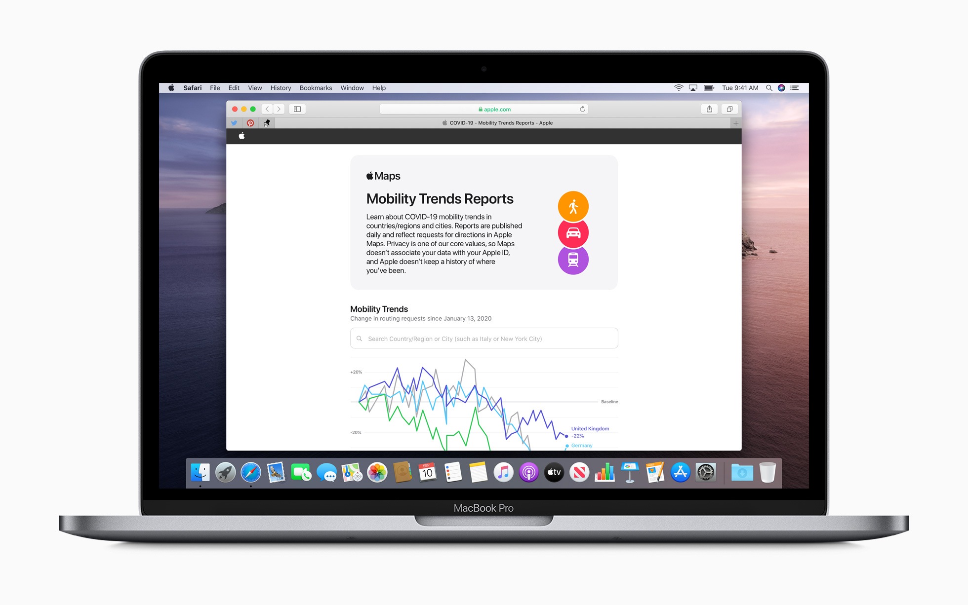
Apple today announced a new online tool which shows mobility data from Apple Maps. The goal of this mobility trends tool is to provide Apple Maps with data that can provide insights to health authorities looking for ways to contain the spread of COVID-19. The press release:
Apple today released an Apple Maps mobility data trends tool to support the global effort to contain the spread of COVID-19. This mobility data can provide useful insights to local governments and health authorities and also inform new public policies by showing changes in the number of people driving, walking, or using public transit in their communities.
Requests to Apple Maps are collected
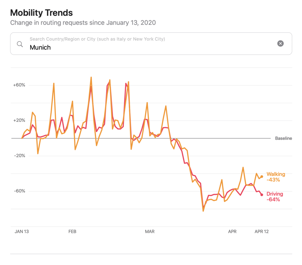
The tool is accessible online to everyone and offers data from major cities and 63 districts or regions. The data is retrieved by entering a specific city or country - see example.
Of course, these are summarized anonymously and therefore not linked to the respective Apple IDs. In addition, the data can be downloaded using CSV. Apple further explains:
This data is generated by counting the number of requests to Apple Maps for directions in selected countries/regions and cities. Data sent to the mapping service from users' devices is linked to random, rotating identifiers, so Apple does not have a profile of your movements and searches.
If you want to try it out yourself, you can find the website below. (Image: Apple)
buying tip: The AirPods 2 and AirPods Pro are available again at Amazon and a little cheaper overall. It's worth being quick.


